Cheorwon is home to reminders of a tragic past
Once a large, prosperous railroad and road junction controlling the Gimhwa Valley, a vital north-south passageway to Seoul, the town of Cheorwon on the central sector of the DMZ was virtually wiped off the map in the bitter fighting of the Korean War (1950–1953). All that remains where the old town stood are shattered ruins in the rice fields, reminders of the tragedy of the fratricidal war. Surrounded by such great natural splendor, these lonely symbols are all the more poignant.

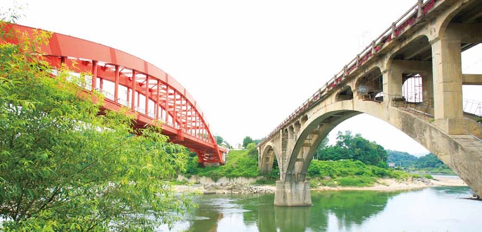
The Seungilgyo Bridge (right), said to have been begun by the North Koreans and finished by the South Koreans. © KTO
Symbols of Division
The ruins of the old Cheorwon office of the Workers’ Party of Korea, the ruling party of North Korea, is perhaps Korea’s most haunting symbol of division and war. One of only a few buildings in Cheorwon whose walls remained standing after the guns fell silent, the bombed-out skeleton of the old Soviet-style office, with its bullet- and shell-scarred façade, recalls images of postwar Germany.
Near the old ruins is a military checkpoint that marks the Civilian Control Line, which delineates a strip of territory just south of the DMZ which civilians need special permission to enter. In this zone, just in front of the southern side of the DMZ, is a small train station. Old Woljeong-ni Station, as this stop is called, is the closest train station to the DMZ in South Korea, although trains stopped running this far north long ago. Behind the station is the old train platform, a rusting sign and the twisted, skeletal remains of a train that was bombed by the Americans during the war.
Nearby is the Cheorwon Peace Observatory, a hilltop observation point accessible using a state-of-the-art monorail. When the weather allows, it offers brilliant views over the entire DMZ and beyond—a rare, relatively unsupervised glimpse into North Korea. In winter, the hot springs around Woljeong-ni Station and the Peace Observatory play host to 110 species of migratory birds, most notably cranes.
Also near the DMZ, but requiring no special permission to visit, is the Buddhist temple Dopiansa, which houses an iron Buddha from the ninth century.

Dopiansa Temple (left) © KTO. Rafting along the Hantangang River (right) © Yonhap News

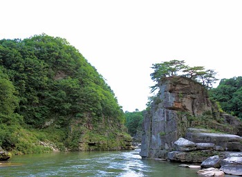
Goseokjeong, one of Korea’s most scenic gorges © KTO
Beauty of the Hantangang River
Several kilometers from the old Workers Party of Korea building is a handsome concrete arch bridge that spans one of the gorges of the Hantangang River. According to popular belief, the Seungilgyo Bridge was started by the North Koreans in 1948 and completed by the South Koreans after the war. As you look closely, you will see that the northern and southern halves of the bridge are clearly of different designs. The architecture of the bridge reflects Korea’s tragic history of division and war. In summer, the waters underneath the bridge become a popular rafting area.
Located not far from the bridge, the Goseokjeong Pavilion overlooks one of Korea’s most beautiful river gorges. The rugged valley, lined by cliffs and fantastic stone formations made of volcanic rock, is sometimes compared to the Grand Canyon of the United States. The area was designated a national scenic spot in 1977.
Many of Cheorwon’s scenic and historical spots are connected by the Cheorwon Soedullegil, a 19 km trekking course that circles the town. The course consists of two sections: The first takes you along the scenic Hantangang River, while the second connects the historical sites, including the Workers’ Party of Korea Building. Far removed from the noise of the city, these trails make a relaxing and educational weekend escape from Seoul.
* Article from Korea Magazine (June 2014)
